
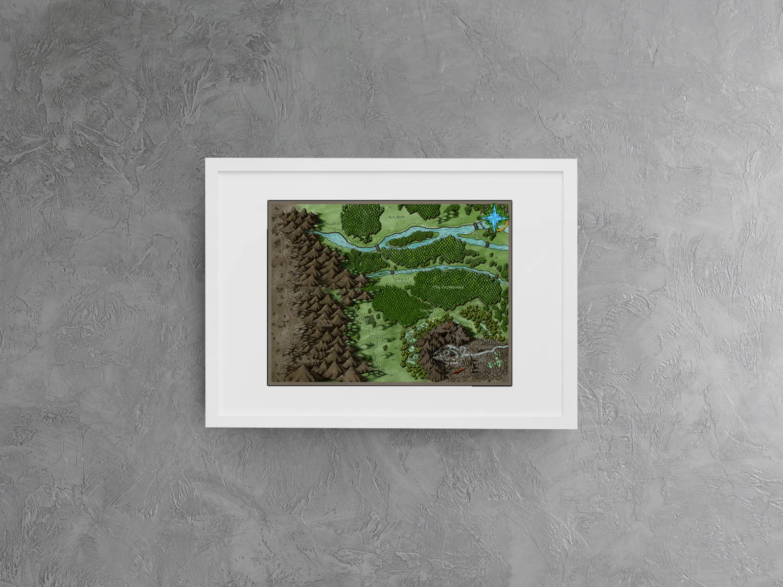
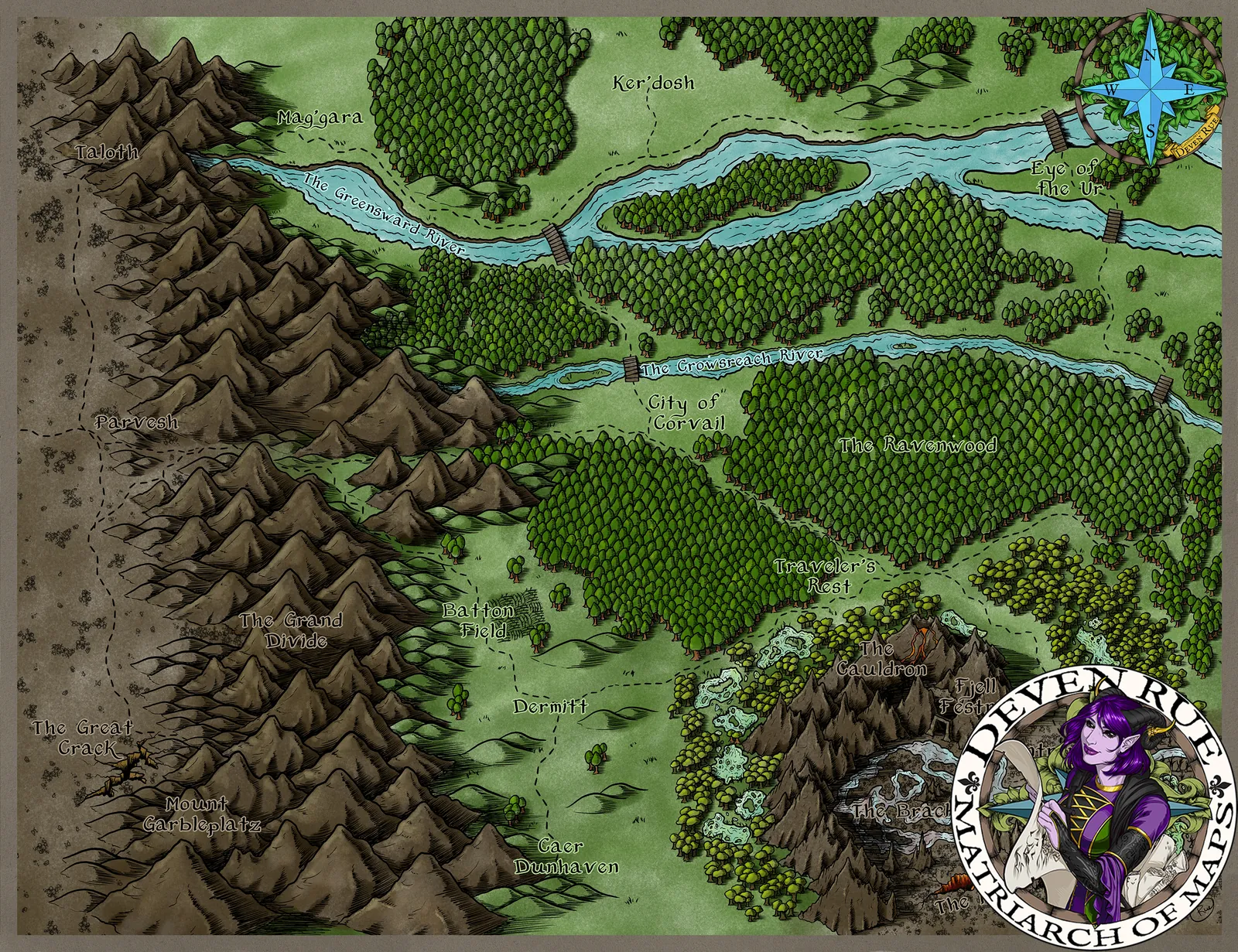
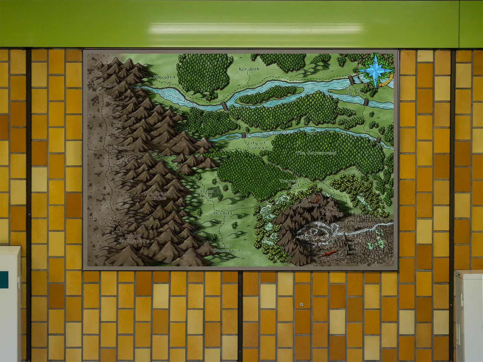
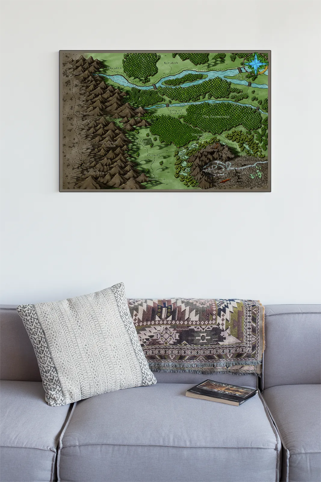
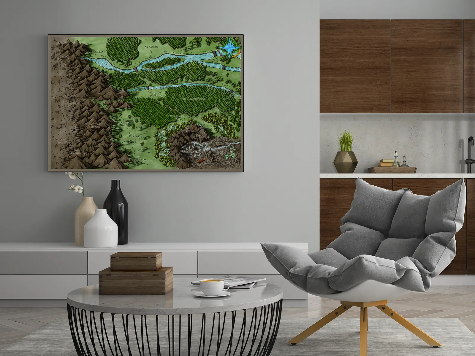
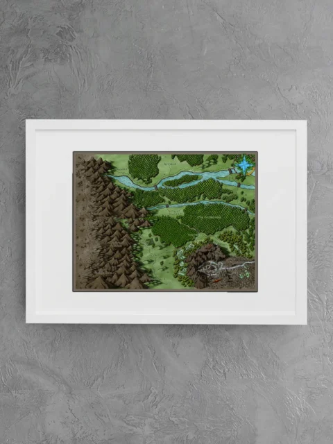
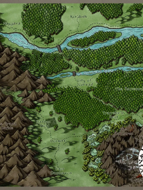
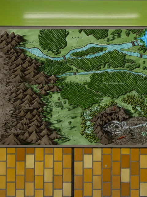
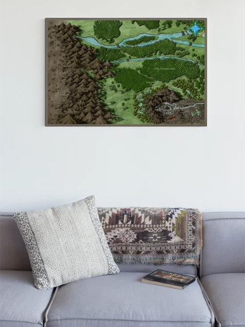
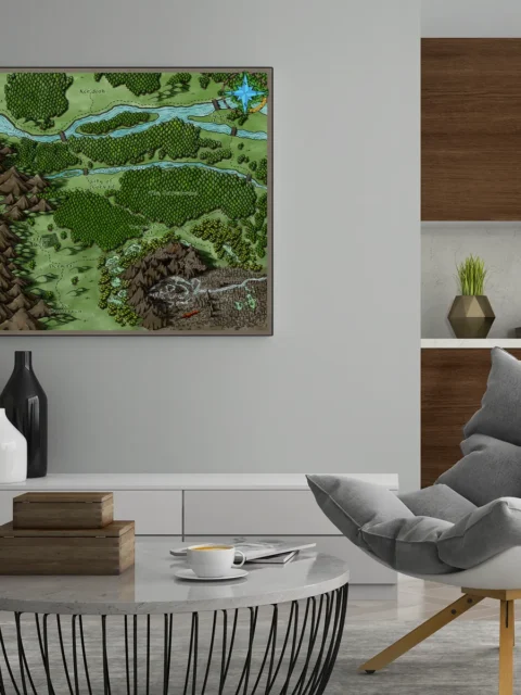


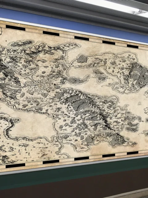
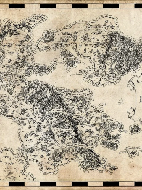
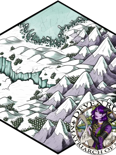
Corvail Map illustrates a richly detailed fantasy region shaped by rivers, forests, and mountain borders that naturally define travel and conflict. Moreover, settlements and landmarks are placed with intention, suggesting trade routes, guarded crossings, and dangerous wilds. This composition makes Corvail Map fantasy regional canvas art an effective tool for long-term storytelling and campaign planning.
Additionally, the map balances dense terrain with open fields, allowing the viewer to quickly understand how movement flows across the land. Forests press close to rivers, mountains form hard boundaries, and named locations anchor narrative focus. However, the clarity of layout ensures the region remains readable even as details accumulate, reinforcing its utility as Corvail Map fantasy regional canvas art rather than a purely decorative piece.
Finally, color and linework work together to convey depth and atmosphere. Moreover, subtle shading separates elevation and terrain types without overwhelming the eye. Consequently, the map delivers both aesthetic appeal and practical reference value.
Features
Hand illustrated fantasy regional map
Clearly marked rivers forests and mountain ranges
Named settlements and landmarks for narrative use
Balanced color palette for clarity and immersion
Designed for tabletop and worldbuilding reference
Use Cases
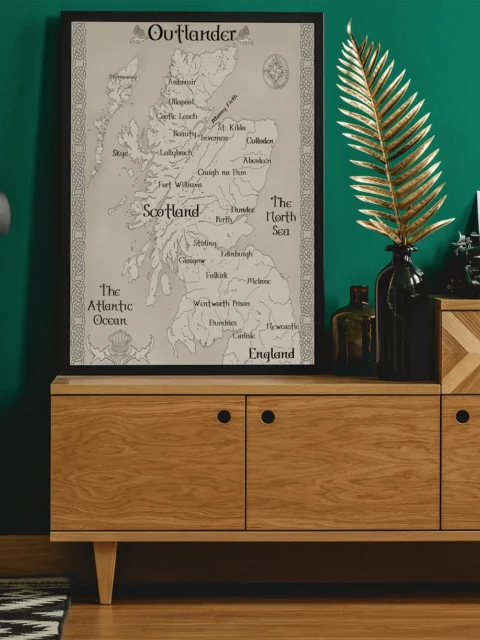
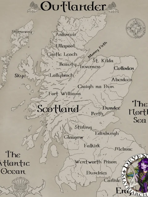
Moreover, this map is ideal for collectors, gamers, and tabletop fans who want a regional setting reference on a wall in a studio, game room, or creative space to support exploration, travel encounters, and local lore development.
Only logged in customers who have purchased this product may leave a review.
Production & Shipping
All Noble Dwarf items are produced to order. Please allow up to 2 weeks for production before your order ships.
Many items ship sooner depending on current production volume, but during high-demand periods or convention season, the full production window may apply.
Once production is complete, you will receive tracking information automatically via email. Shipping time varies based on carrier and destination.
If you have a deadline or special request, please contact us prior to ordering and we will do our best to accommodate.


Related products


Alyssa Faden Cartography


Alyssa Faden Cartography


Alyssa Faden Cartography


Alyssa Faden Cartography


Alyssa Faden Cartography


Alyssa Faden Cartography


Alyssa Faden Cartography


Alyssa Faden Cartography
Reviews
There are no reviews yet.