
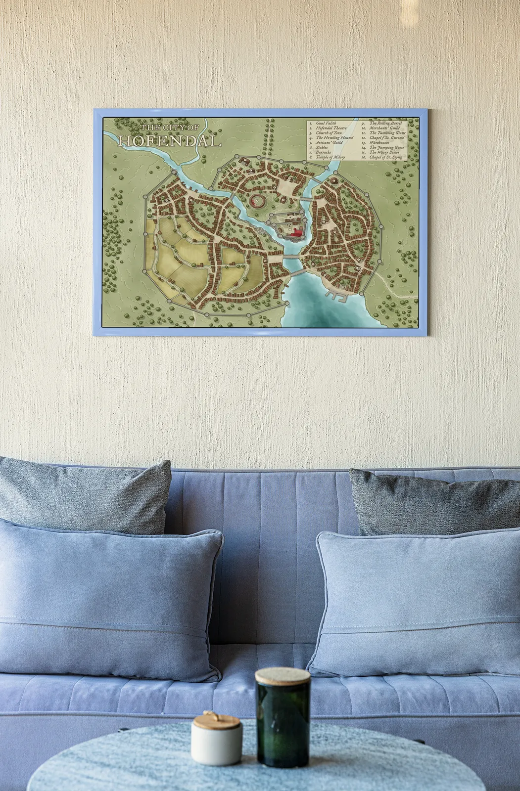
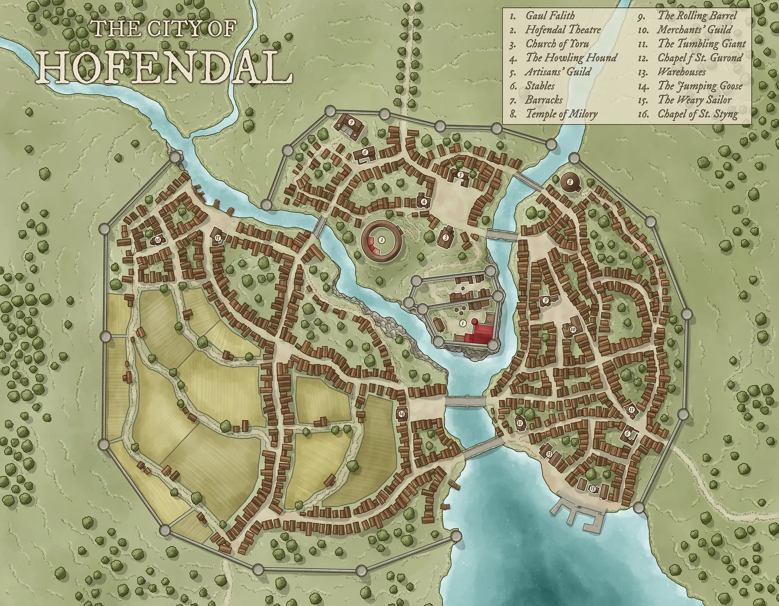
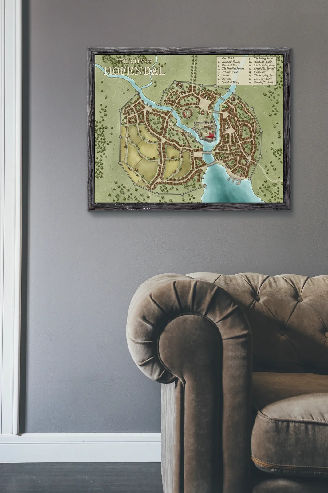

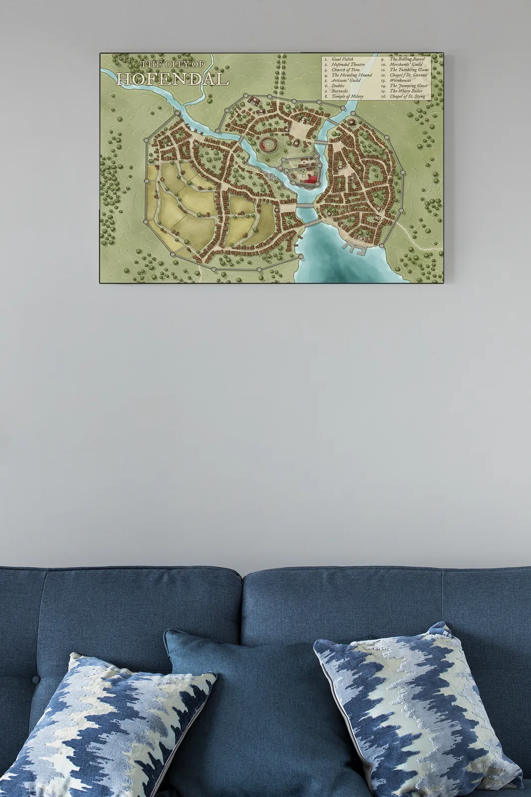
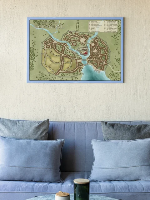
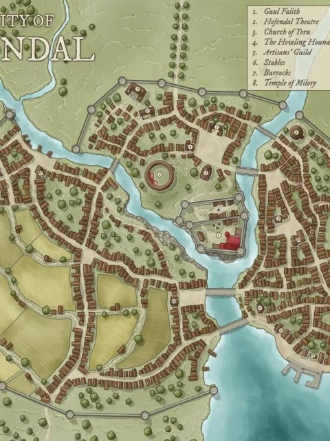
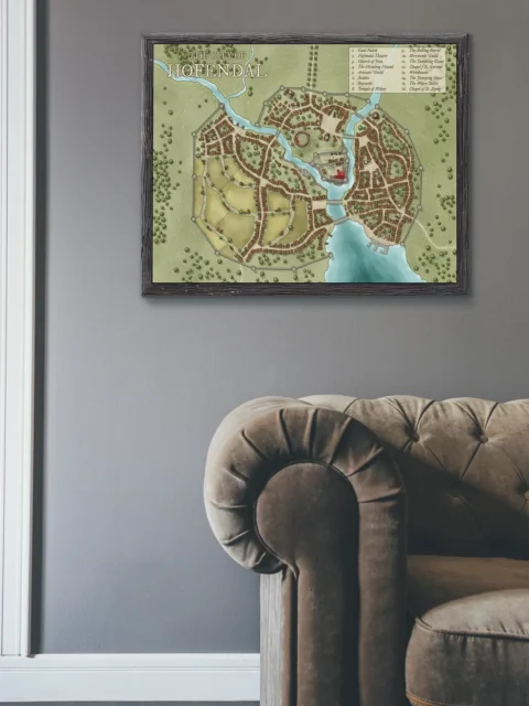

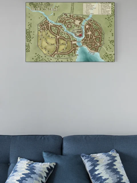


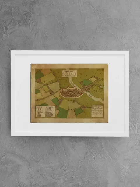
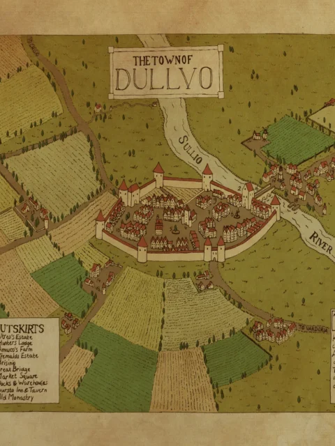
The Hofendal City Fantasy Map depicts a fortified river city divided by flowing waterways, bridges, and defensive walls. Distinct districts curve along the riverbanks, while farmland and outer neighborhoods spread beyond the inner city. As a result, the map immediately conveys a sense of scale, planning, and civic structure.
Moreover, the layout highlights Hofendal’s relationship with trade and defense. Walled sections protect dense residential quarters, temples, guild halls, and theaters, while bridges connect key districts across the river. Consequently, Dungeon Masters can easily stage political intrigue, urban exploration, or conflict between neighborhoods shaped by geography.
Finally, the Hofendal City Fantasy Map functions equally well as a storytelling tool and a display piece. Above all, it supports campaigns centered on city life, social tension, and layered urban history, while remaining clear and readable at the table or on the wall.
Features
Detailed fantasy city map with walls and river divisions
Clearly defined districts, bridges, and civic landmarks
Designed for urban adventures and political storytelling
Balanced composition with residential, religious, and trade areas
Printed on archival-quality canvas for long-term display
Use Cases
Ideal for Dungeon Masters running city-based campaigns, writers developing urban settings, or collectors seeking classic fantasy city cartography.
Only logged in customers who have purchased this product may leave a review.
Production & Shipping
All Noble Dwarf items are produced to order. Please allow up to 2 weeks for production before your order ships.
Many items ship sooner depending on current production volume, but during high-demand periods or convention season, the full production window may apply.
Once production is complete, you will receive tracking information automatically via email. Shipping time varies based on carrier and destination.
If you have a deadline or special request, please contact us prior to ordering and we will do our best to accommodate.
Daniel's Maps
Daniel's Maps


Daniel's Maps
Daniel's Maps
Related products


Alyssa Faden Cartography


Alyssa Faden Cartography


Alyssa Faden Cartography


Alyssa Faden Cartography


Alyssa Faden Cartography


Alyssa Faden Cartography


Alyssa Faden Cartography
Reviews
There are no reviews yet.