
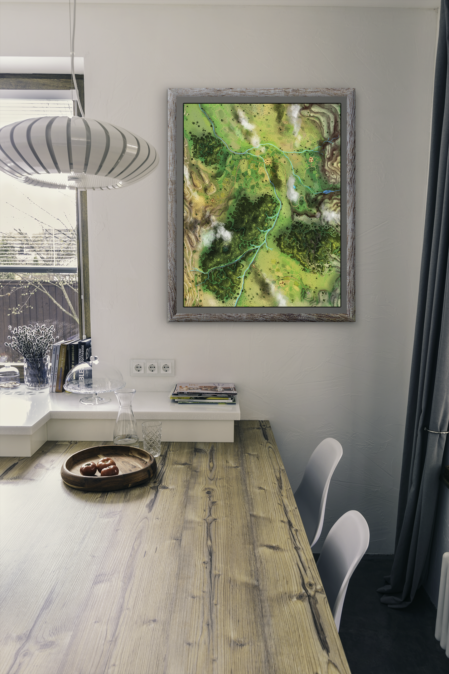
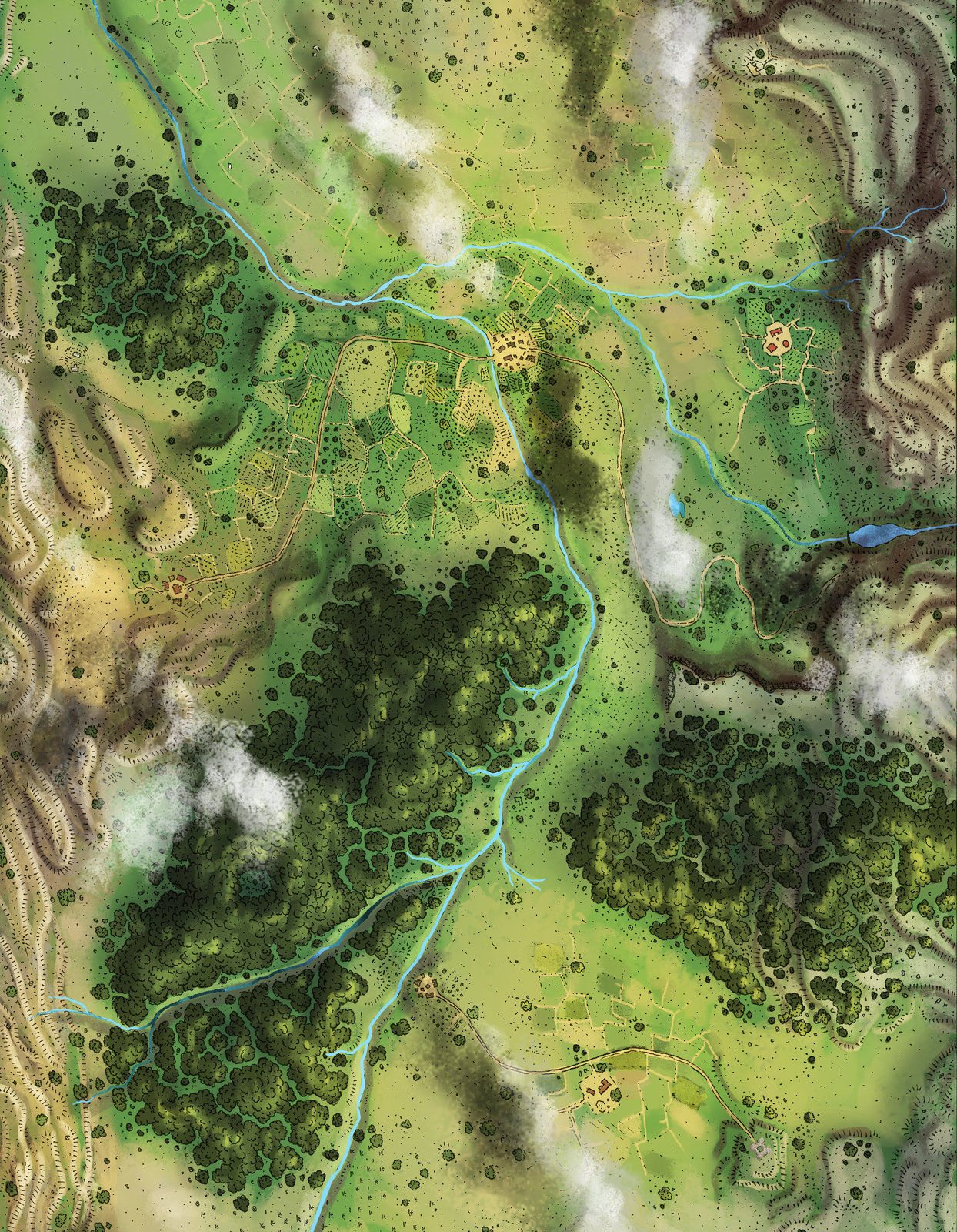
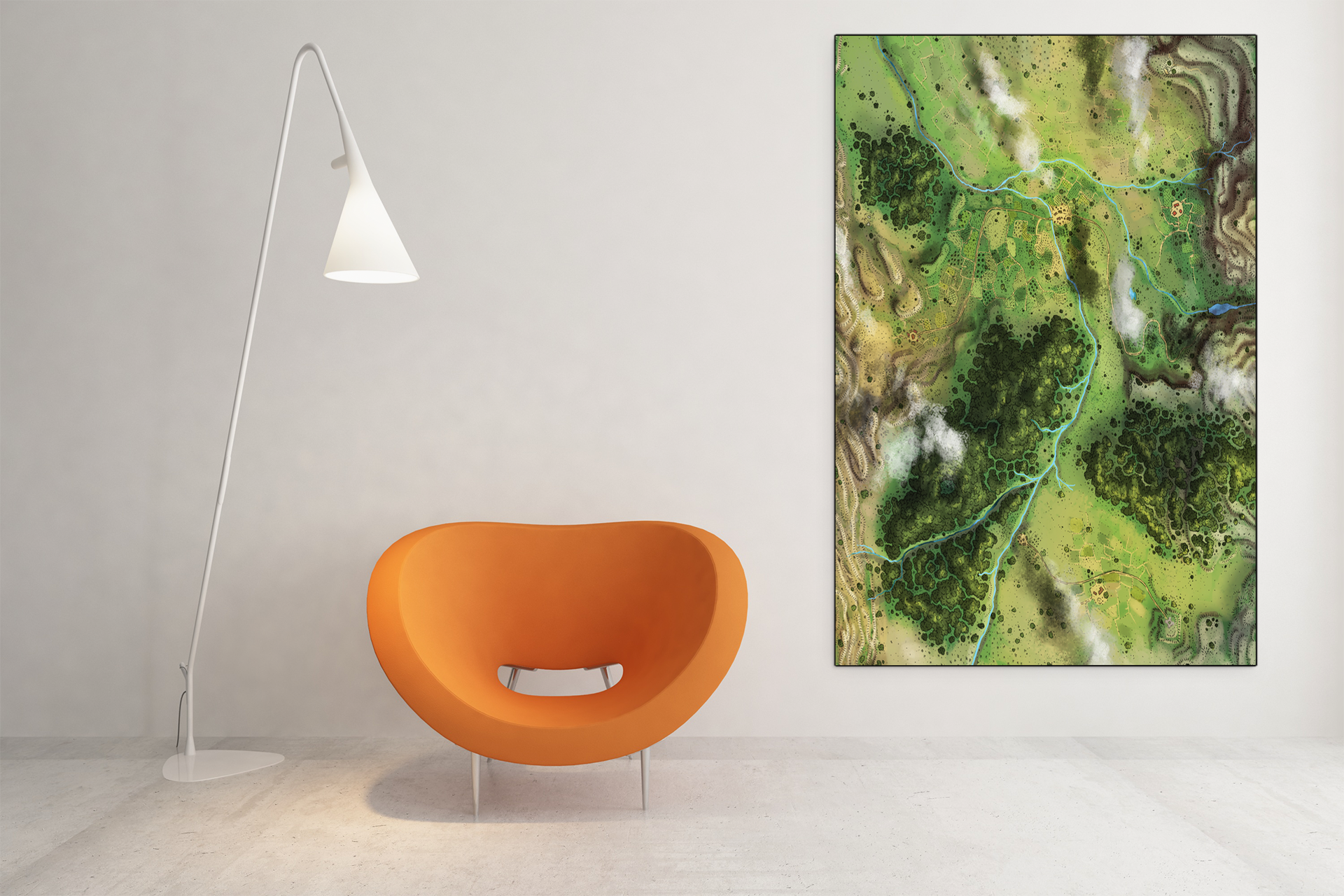
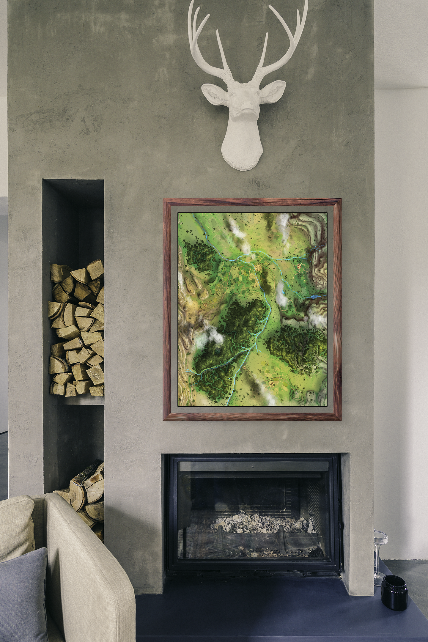
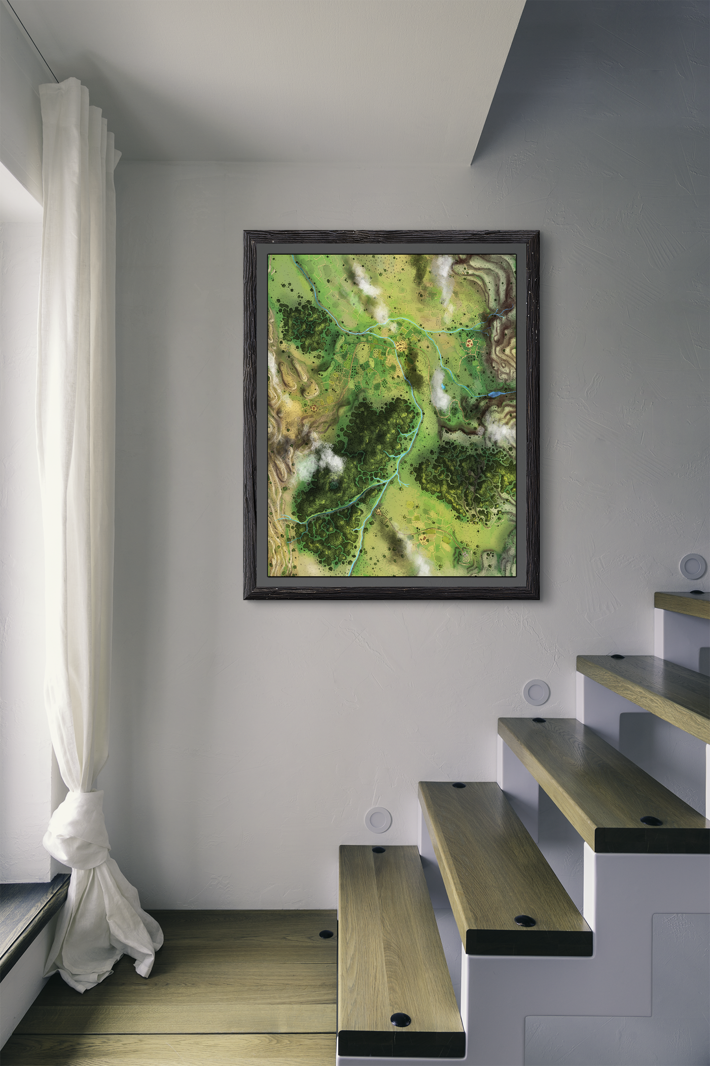


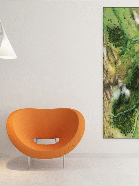
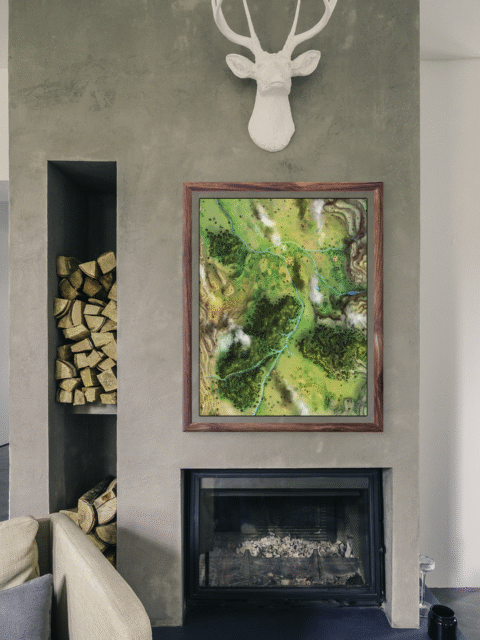
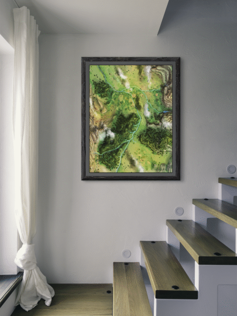


A pale blue river winds through fertile valley farmland. Connecting clusters of tan settlements against dense forest and distant mountain ridges. This brycshire fantasy map canvas print captures a complete river basin ecosystem from an elevated perspective. In particular, the scattered cloud formations add atmospheric layering without obscuring the underlying geography.
Additionally, the forest regions dominate the lower terrain with clustered tree canopy detail rendered in deep green tones. Agricultural fields surrounding each settlement show organized yellow-green patterns that suggest cultivation and trade routes. The mountain ranges, moreover, frame the valley edges with rippled topographic texture that defines watershed boundaries.
The composition balances pastoral detail with readable geographic structure at display scale. Dense visual information rewards inspection without overwhelming the brycshire fantasy map canvas print’s clarity as a navigable territory. Particularly appealing is the way settlement placement suggests a functioning trade network along the river system.
About This Canvas Print
- Printed on premium artist-grade canvas using archival inks rated for 100+ years of fade resistance
- Flat canvas print — no frame, no matting, giving you complete flexibility to display it your way
- The 1.5-inch border on all sides is designed for gallery wrapping around a stretcher frame or standard framing — the image area stays fully intact
- High-resolution printing captures fine line detail, color gradients, and subtle textures across the full image
- Printed and shipped from the USA — ready to display, frame, or wrap when it arrives
Display Ideas
Works for tabletop RPG campaign settings where river valley trade routes drive regional conflict and exploration. Also suits fantasy novel readers who appreciate illustrated geography that rewards detailed study.
Only logged in customers who have purchased this product may leave a review.
Production & Shipping
All Noble Dwarf items are produced to order. Please allow up to 2 weeks for production before your order ships.
Many items ship sooner depending on current production volume, but during high-demand periods or convention season, the full production window may apply.
Once production is complete, you will receive tracking information automatically via email. Shipping time varies based on carrier and destination.
If you have a deadline or special request, please contact us prior to ordering and we will do our best to accommodate.


Alyssa Faden Cartography


Alyssa Faden Cartography


Alyssa Faden Cartography


Alyssa Faden Cartography


Alyssa Faden Cartography


Alyssa Faden Cartography
Related products
Alyssa Faden Cartography


Alyssa Faden Cartography


Alyssa Faden Cartography


Alyssa Faden Cartography


Alyssa Faden Cartography


Alyssa Faden Cartography


Alyssa Faden Cartography
Luxemburg Star Fortress Ac Fantasy Wall Art from Alyssa Faden


Alyssa Faden Cartography
Reviews
There are no reviews yet.