

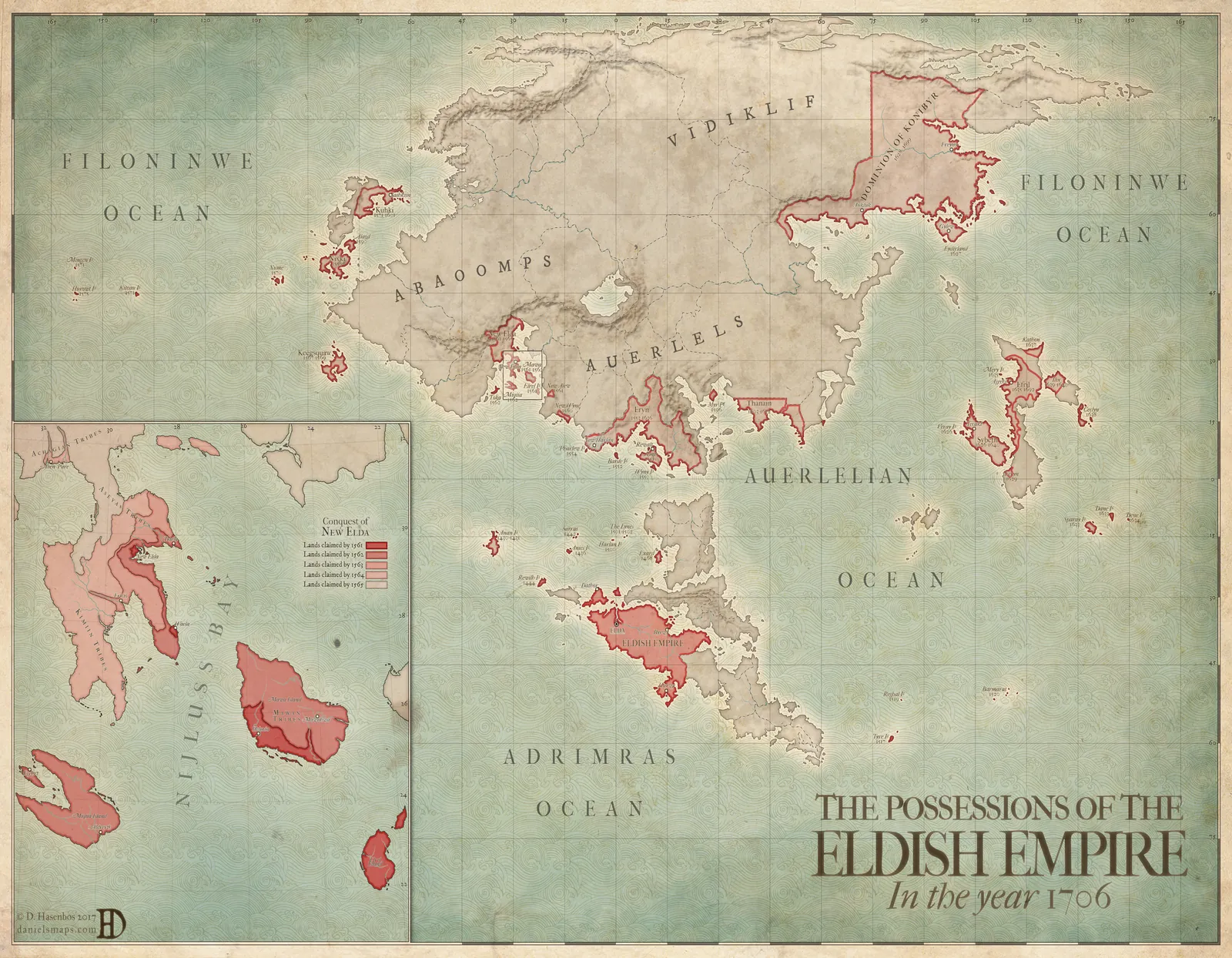

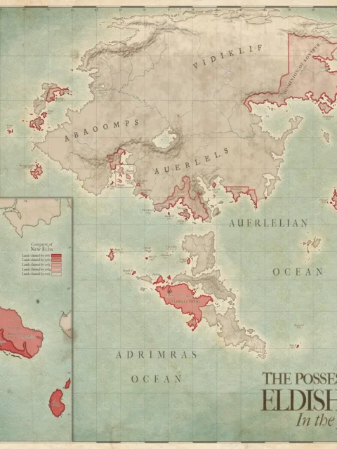


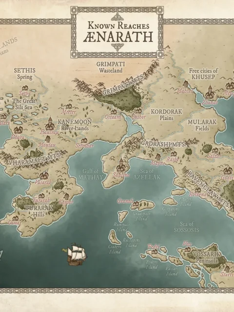
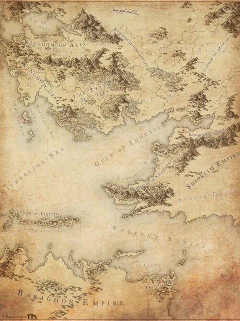
The Elda – Possessions of the Eldish Empire Fantasy Map presents a sweeping political view of a vast fantasy world shaped by conquest and expansion. Coastlines, island chains, and continental regions are clearly defined, while red borders mark the territorial reach of the Eldish Empire in the year 1706. As a result, this Elda fantasy map communicates power, scale, and historical momentum at a glance.
Moreover, Daniels Maps uses restrained color and precise cartographic styling to emphasize political boundaries without overwhelming geographic detail. Consequently, viewers can easily distinguish imperial holdings from surrounding lands and seas. This clarity makes the Eldish Empire fantasy map especially useful for campaigns involving empires, rebellion, trade routes, or large-scale warfare.
Finally, the Elda Eldish Empire Map excels as both a storytelling tool and a display piece. Above all, it supports worldbuilders who need a believable imperial footprint while also offering collectors a refined, museum-style fantasy map suitable for long-term wall display.
Features
Large-scale political fantasy map by Daniels Maps
Highlights the territorial reach of the Eldish Empire
Clearly marked regions, oceans, and island groups
Designed for worldbuilding, empire-level storytelling, and display
Printed on archival-quality canvas
Use Cases
Ideal for Dungeon Masters running empire-driven campaigns, writers developing political histories, or collectors seeking large-format fantasy world maps.
Only logged in customers who have purchased this product may leave a review.
Production & Shipping
All Noble Dwarf items are produced to order. Please allow up to 2 weeks for production before your order ships.
Many items ship sooner depending on current production volume, but during high-demand periods or convention season, the full production window may apply.
Once production is complete, you will receive tracking information automatically via email. Shipping time varies based on carrier and destination.
If you have a deadline or special request, please contact us prior to ordering and we will do our best to accommodate.

Daniel's Maps

Daniel's Maps
Daniel's Maps

Daniel's Maps

Related products


Alyssa Faden Cartography
Rayley Alternate Color City Map by Alex – Archival Canvas Print


Alyssa Faden Cartography


Alyssa Faden Cartography


Alyssa Faden Cartography


Alyssa Faden Cartography
Luxemburg Star Fortress Ac Fantasy Wall Art from Alyssa Faden


Alyssa Faden Cartography


Alyssa Faden Cartography


Alyssa Faden Cartography
Reviews
There are no reviews yet.