
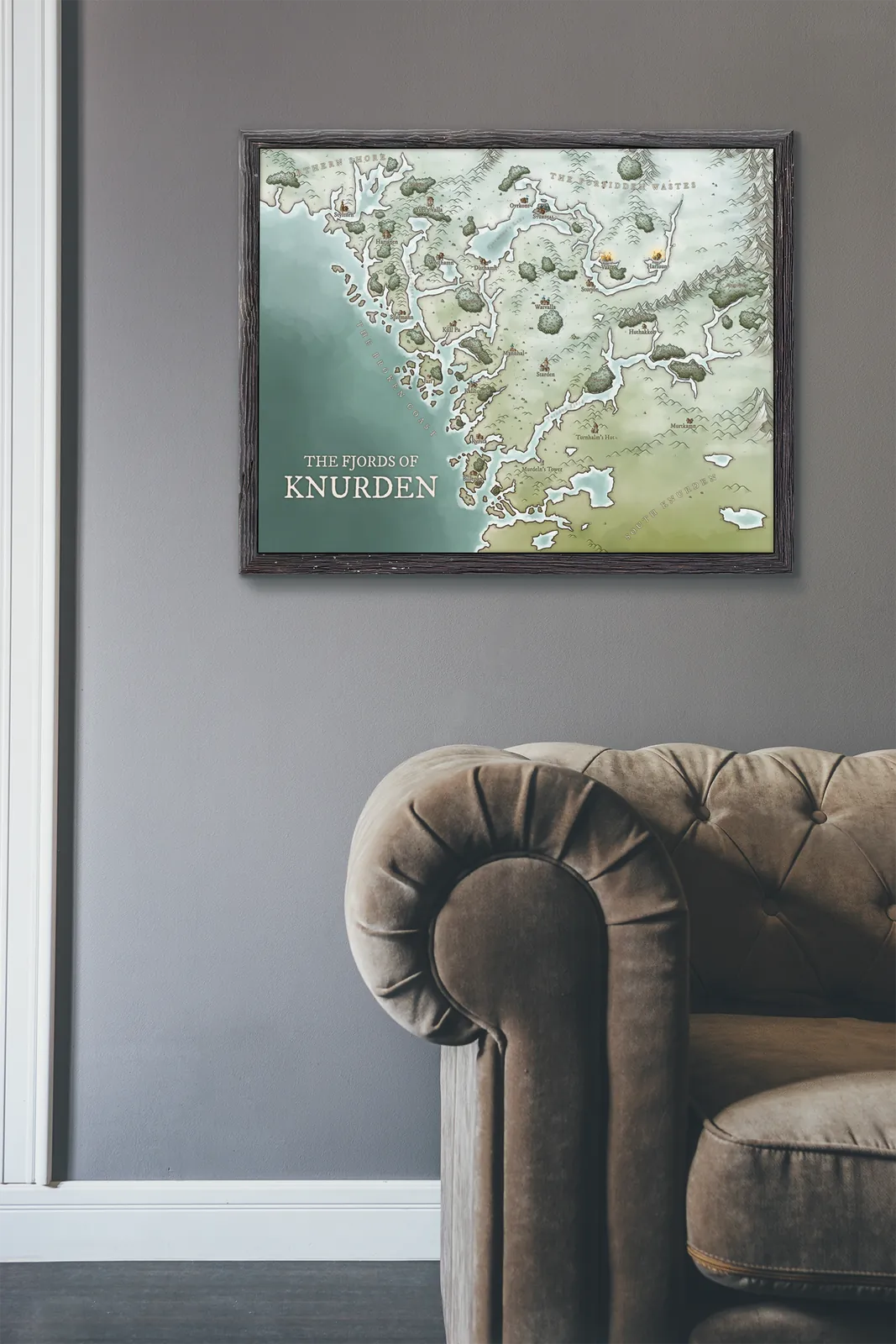
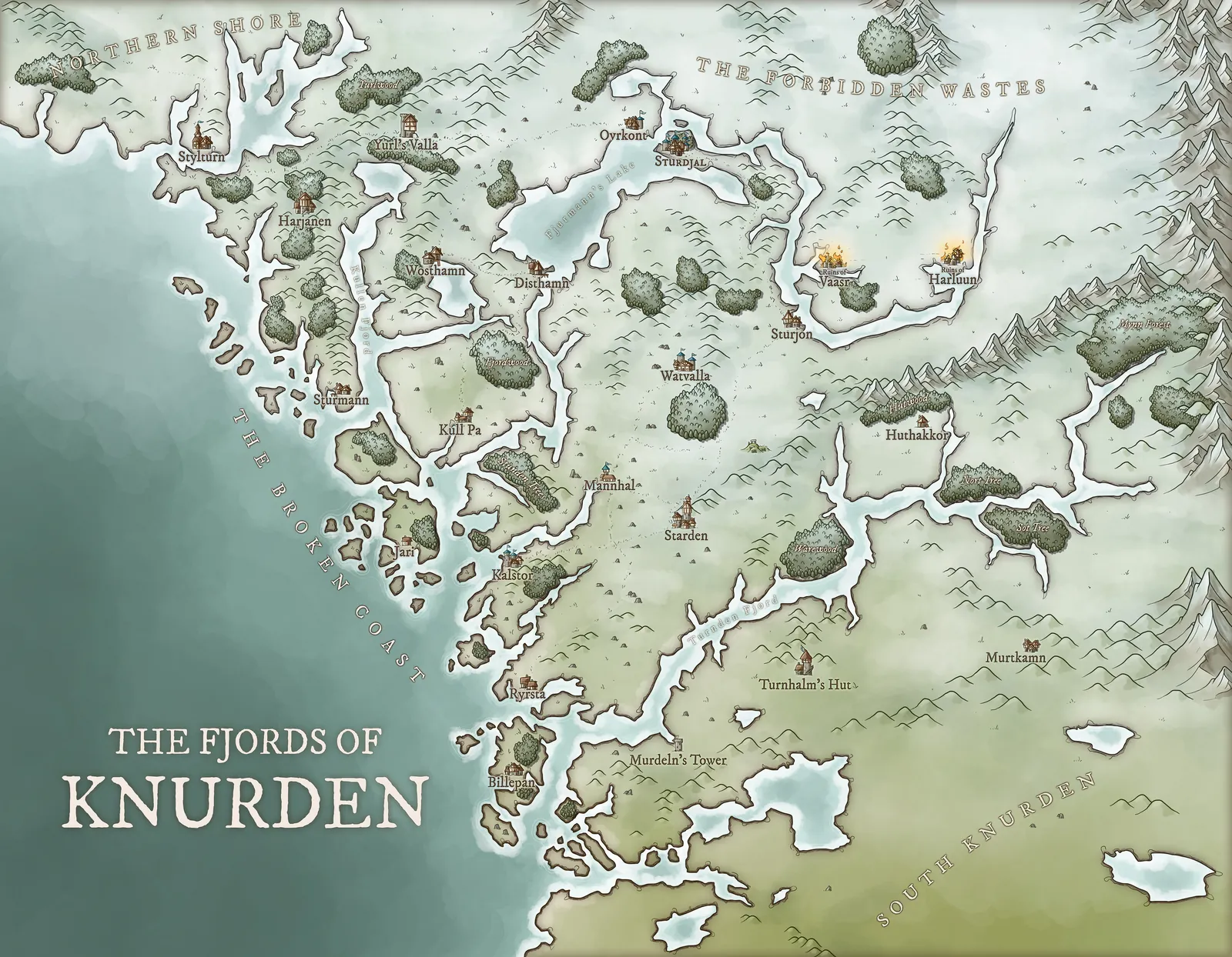
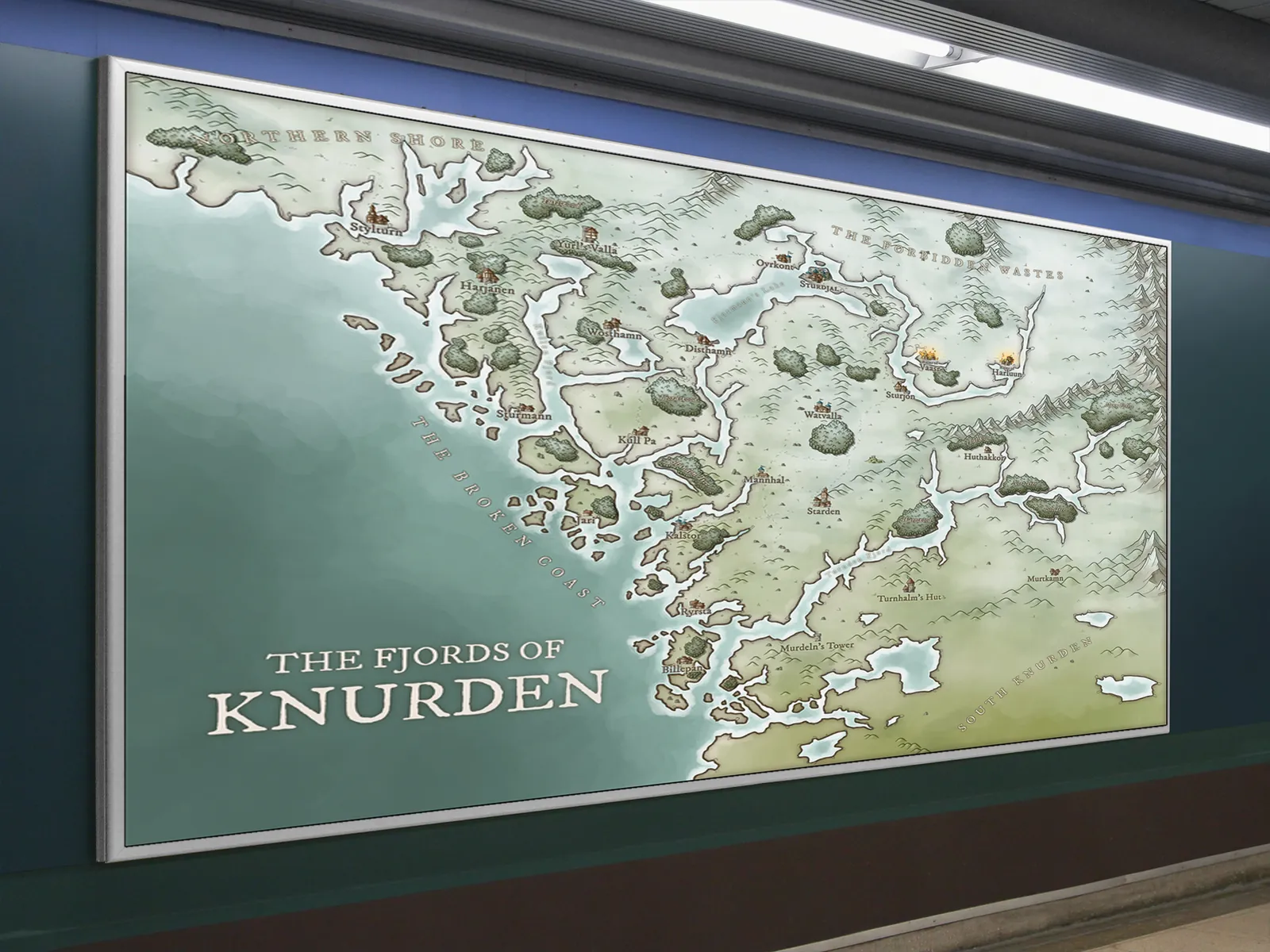
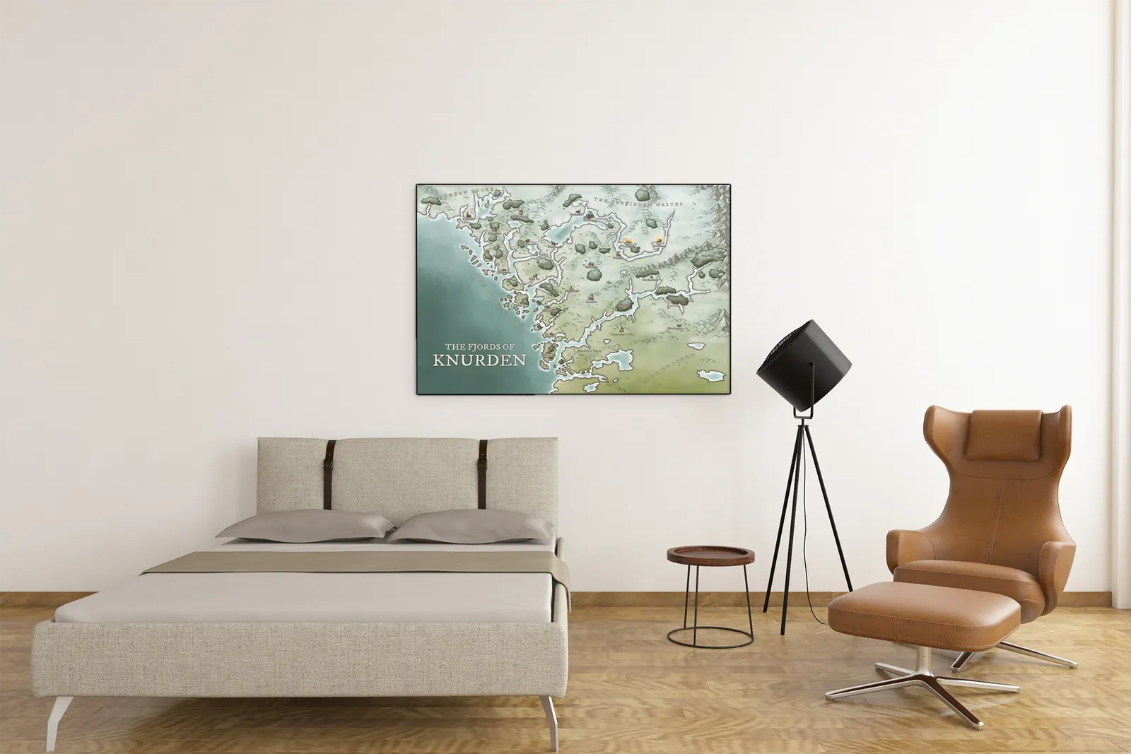
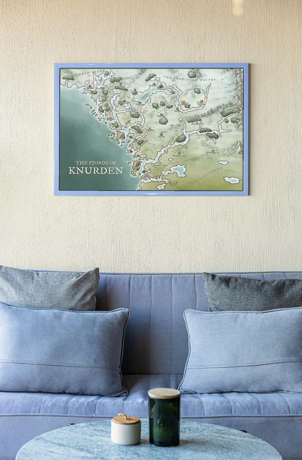
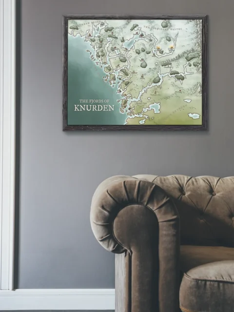
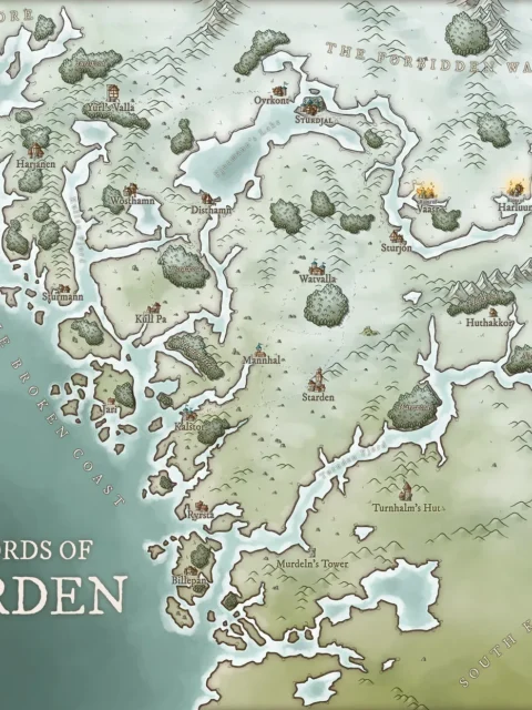
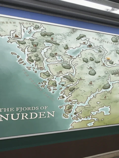
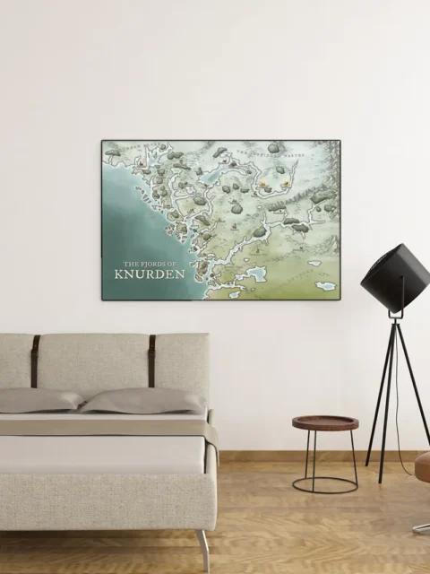
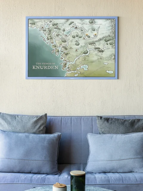


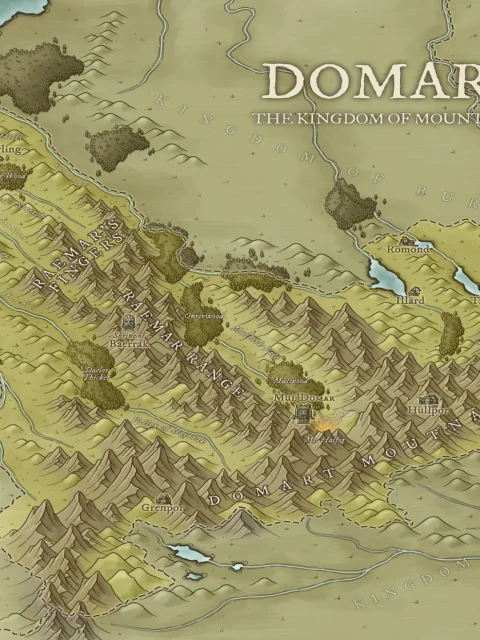
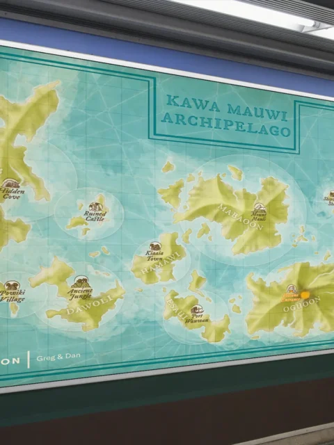
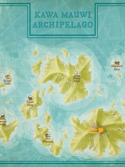
The Fjords of Knurden Fantasy Regional Map presents a rugged northern coastline defined by deep fjords, broken shores, and scattered settlements. Winding waterways carve through the land, while forests, hills, and mountain ranges frame isolated villages and strongholds. As a result, the map immediately conveys a harsh but livable frontier shaped by water, weather, and distance.
Moreover, the clear separation between coastal routes and inland regions supports layered exploration. Therefore, Dungeon Masters can easily design naval travel, ambush points, and slow overland journeys between communities. At the same time, the readable geography allows players to understand scale and terrain without confusion.
Finally, this regional map functions as a strong foundation for exploration-driven campaigns. Above all, it encourages stories centered on survival, trade, and political tension along the coast. Consequently, it works especially well for long-term adventures set in remote northern lands.
Features
Detailed fantasy regional map focused on fjords and coastal terrain
Deep waterways, islands, and rugged shorelines clearly defined
Includes settlements, towers, forests, and inland routes
Designed for exploration, travel, and frontier-based campaigns
Produced on archival-grade material for lasting display
Use Cases
Ideal for Dungeon Masters running exploration-heavy or coastal campaigns, writers developing northern fantasy regions, or collectors seeking detailed regional fantasy cartography.
Only logged in customers who have purchased this product may leave a review.
Production & Shipping
All Noble Dwarf items are produced to order. Please allow up to 2 weeks for production before your order ships.
Many items ship sooner depending on current production volume, but during high-demand periods or convention season, the full production window may apply.
Once production is complete, you will receive tracking information automatically via email. Shipping time varies based on carrier and destination.
If you have a deadline or special request, please contact us prior to ordering and we will do our best to accommodate.

Daniel's Maps
Daniel's Maps

Daniel's Maps

Related products


Alyssa Faden Cartography


Alyssa Faden Cartography
Luxemburg Star Fortress Ac Fantasy Wall Art from Alyssa Faden


Alyssa Faden Cartography


Alyssa Faden Cartography


Alyssa Faden Cartography


Alyssa Faden Cartography


Alyssa Faden Cartography


Alyssa Faden Cartography
Reviews
There are no reviews yet.