
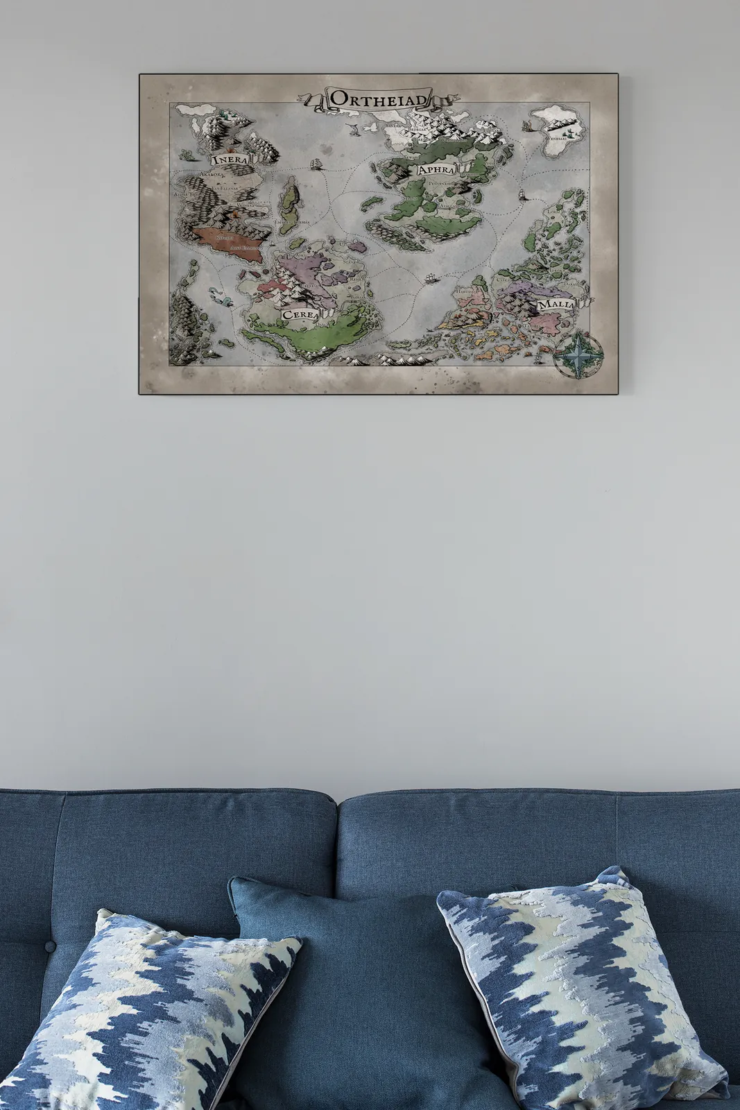
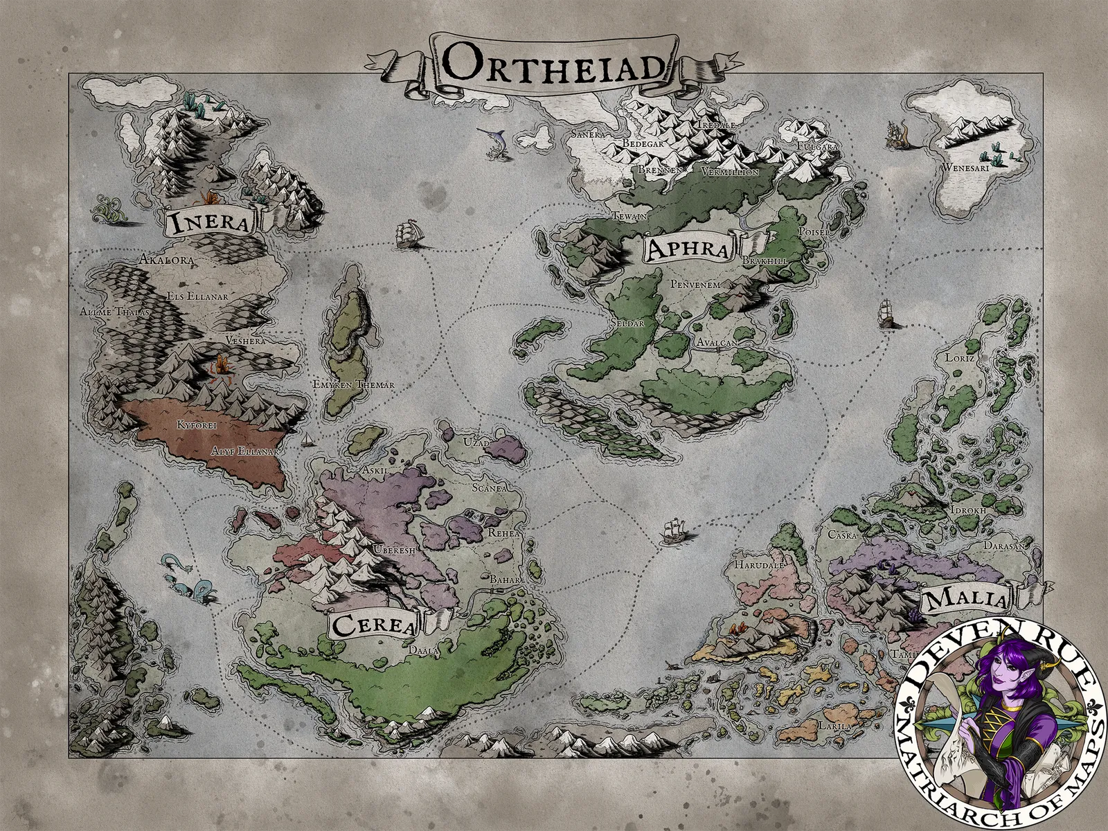

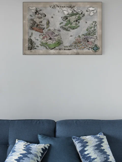
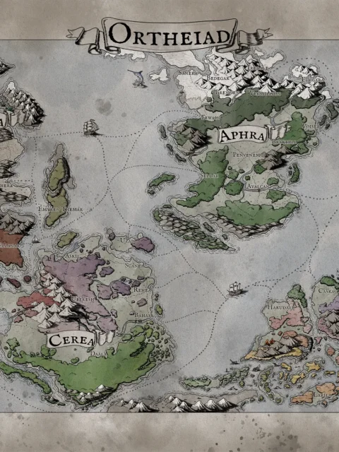
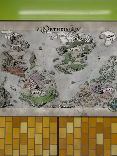
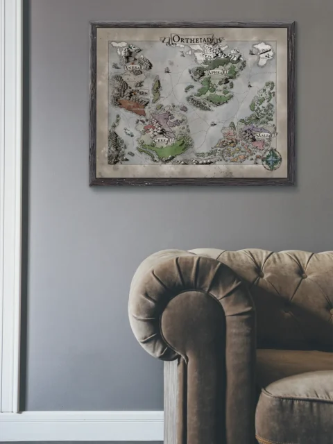
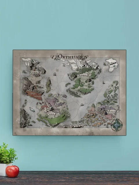


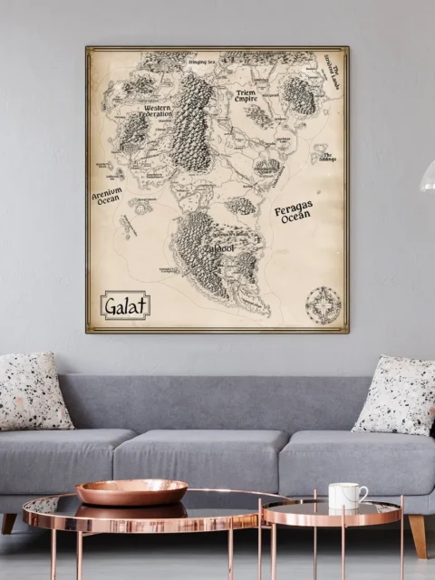
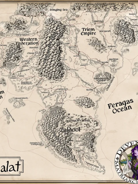
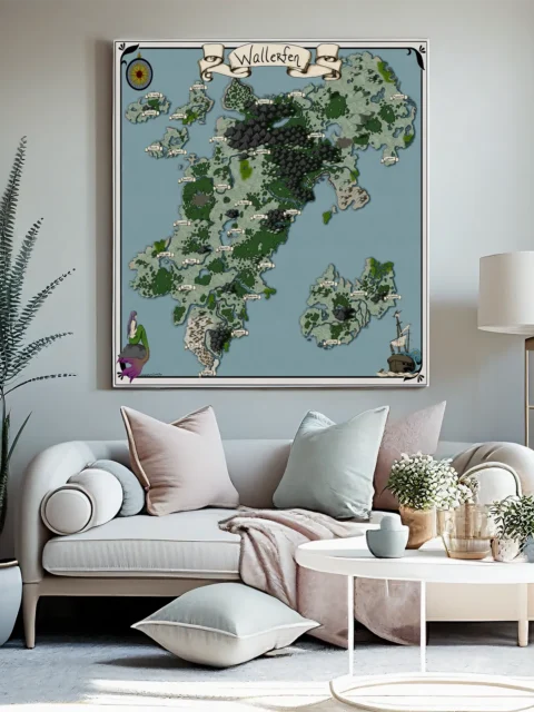
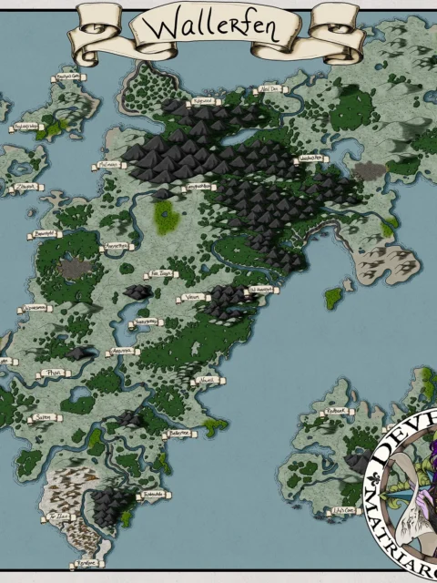
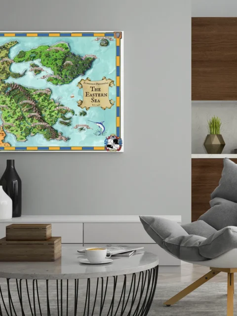
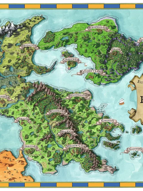
Ortheiad Map presents a vast seafaring realm shaped by distance, currents, and divided powers. Moreover, the Ortheiad fantasy archipelago world map canvas establishes scope immediately through scattered continents and measured trade routes. Mountain chains rise sharply, while coastlines fracture into navigable bays and contested waters.
Ortheiad Map is composed to emphasize balance between land and sea. Additionally, the spacing of regions reinforces long travel arcs and political separation. Routes between Aphra, Cerea, and Malia guide narrative movement across open water.
Ortheiad Map uses restrained color fields with clear line definition. Consequently, each territory remains legible without visual noise. The overall effect supports clarity, strategy, and long-form worldbuilding.
Features
Expansive archipelago geography with clear regional separation
Defined sea routes supporting naval travel narratives
Balanced land-to-water composition for strategic play
Hand-rendered terrain with readable elevation changes
Designed specifically for premium canvas presentation
Use Cases
Additionally, this piece suits collectors, gamers, and tabletop fans who want a commanding reference for a wall, studio, game room, or creative space focused on naval campaigns, political intrigue, and exploration.
Only logged in customers who have purchased this product may leave a review.
Production & Shipping
All Noble Dwarf items are produced to order. Please allow up to 2 weeks for production before your order ships.
Many items ship sooner depending on current production volume, but during high-demand periods or convention season, the full production window may apply.
Once production is complete, you will receive tracking information automatically via email. Shipping time varies based on carrier and destination.
If you have a deadline or special request, please contact us prior to ordering and we will do our best to accommodate.

Related products


Alyssa Faden Cartography


Alyssa Faden Cartography


Alyssa Faden Cartography


Alyssa Faden Cartography


Alyssa Faden Cartography


Alyssa Faden Cartography


Alyssa Faden Cartography
Reviews
There are no reviews yet.